My Youtube channel
Hopefully a great place for inspiration and a bit of learning.
My Facebook Page
All my Drone Adventures go on here
Drone Insurance
I have written more about Drone Insurance here, but the company that I currently use is Coverdrone.
Weather App
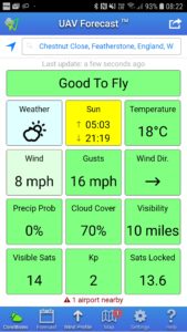
If you want to know whether the weather is good to fly then use the UAV Forecast app.
REMEMBER: You set the parameters, so if you think your drone will fly in a 25mph wind then set it up this way. (Good luck)
Android: https://play.google.com/store/apps/details?id=com.uavforecast
Apple: https://itunes.apple.com/gb/app/uav-forecast/id1050023752?mt=8
National Trust Land
There are many sites around the UK where land is owned by the National Trust but unfortunately NT do not allow you to set off from their land (Although in quiet times I have found some friendly staff :-))
There aren't any rules about flying OVER National Trust land as long as you follow the Drone Code and any other local rules.
I find this link useful to find out where NT land is:
https://www.nationaltrust.org.uk/features/follow-the-history-of-our-places-with-land-map
Who Owns England
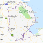
It is useful to know that you can't take off from National Trust land but you are allowed to take off from the Crown Estate (Land owned by the queen), as long as you follow the drone code. This map looks to tell you about both.
Drone Assist - NATS App
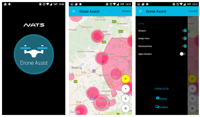
This is a "Must Have" application which can tell you lots of useful information about where you are planning to fly. Please check this before you fly.
Android: https://play.google.com/store/apps/details?id=uk.co.nats.droneassist
Apple: https://itunes.apple.com/gb/app/nats-drone-assist-helping-you-to-fly-safely/id1172916055?mt=8
UAV Data
Some drones like DJI drone keep masses of data about your flight which is interesting and useful.
AirData allows you to visualise your data for free using this website.
It tells you things like how your batteries are doing, is your drone turning quicker in one direction than another and suggests maintenance
Photo editing
Affinity photos is great but doesn't cost as much as other tools.
Register your drone
It is now UK law to register your drone if the drone is over 250 grams.
https://register-drones.caa.co.uk/individual/register-and-take-test-to-fly
Video Editing
I like to use Davinci Resolve. This is because it has loads of features and it is free!!!
It does take a bit of effort to learn but well worth the effort and lots of videos on YouTube to help you.
https://www.blackmagicdesign.com/uk/products/davinciresolve/
Help with Davinci Resolve
For help with Davinci Resolve ,there are plenty of YouTube videos but I found these 5 minute clips REALLY useful and easy to understand.
https://www.youtube.com/playlist?list=PLwuzxyFDGVDCHbXUP-5ozTxVVcCHr2nBi
Golden Hour App
This App helps me to know when the sun rises and falls, which direction and when the "Golden Hour" is - The perfect time for landscape photography.
Drone Adventure Facebook Group
I'd love to see your Drone Adventures. Please post them here.
