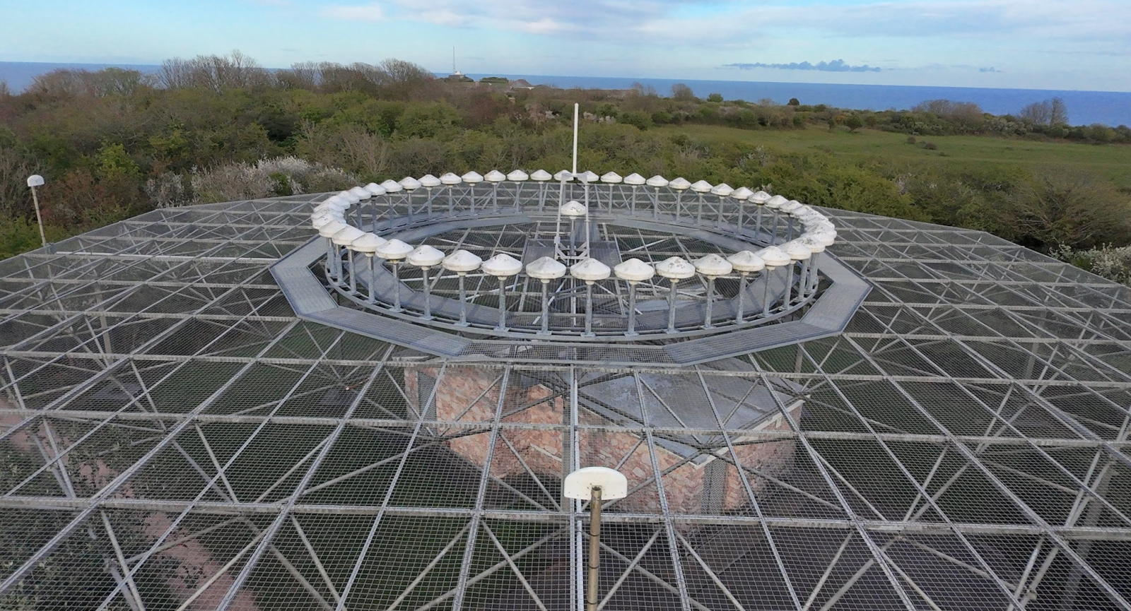
It began, as many modern explorations do, with a digital map. Scrolling across the familiar coastline of South Devon on Google Maps, a peculiar, almost technical-looking structure caught my eye atop the dramatic cliffs of Berry Head. A quick search revealed it to be a VOR/DME beacon, a piece of navigational technology crucial for aviation. VOR stands for VHF Omnidirectional Range, a type of short-range radio navigation system for aircraft, enabling them to determine their bearing relative to the ground station. DME, or Distance Measuring Equipment, complements this by providing the aircraft with slant-range distance to the beacon. Intrigued by this blend of natural beauty and technological purpose, I felt compelled to learn more about this coastal sentinel.
Berry Head itself is a truly captivating location. This prominent headland, a National Nature Reserve, juts boldly into Tor Bay, offering breathtaking panoramic views stretching across the Devon coastline. Its rugged limestone cliffs are home to a wealth of wildlife, including a significant guillemot colony, and are steeped in history, with evidence of Iron Age fortifications and Napoleonic-era military installations. The air here is often alive with the cries of seabirds and the invigorating tang of the sea.
Nestled at the foot of Berry Head lies the charming fishing town of Brixham. A historic port with a vibrant atmosphere, Brixham is known for its picturesque harbour filled with colourful trawlers, its bustling fish market, and its rich maritime heritage. The town's narrow streets wind past traditional pubs and quaint shops, leading up to higher ground with stunning views of the bay. Brixham's strong connection to the sea makes the presence of a navigational beacon on the overlooking headland seem particularly fitting.
To gain a different perspective on this intriguing structure, I recently embarked on a drone adventure. Taking to the skies with my DJI Neo, I was initially mindful of potential interference that such a powerful radio beacon might cause. However, with careful planning and adherence to regulations, the flight proved to be a fascinating experience. From above, the VOR/DME beacon stood out starkly against the green landscape, its circular antenna array a testament to its function. The drone's camera captured the beacon's relationship with the dramatic cliffs, the vast expanse of the sea beyond, and the distant rooftops of Brixham, offering a unique visual narrative of this coastal landmark.
The Berry Head VOR/DME beacon, therefore, is more than just a piece of navigational equipment. It's a point of intersection between human technology and the raw beauty of nature, a silent guardian watching over the bustling activity below and guiding aircraft safely along their routes. It serves as a reminder of the unseen infrastructure that underpins modern life, often unnoticed until a digital map sparks a moment of curiosity and leads to a fascinating exploration of our surroundings.
Drone video of Berry Head VOR/DME beacon
Don'y forget to also subscribe to the UK Drone Adventure YouTube channel (It's free)
Location map of theBerry Head VOR/DME beacon
Some photos of Berry Head VOR/DME beacon, the fort and Brixham


More places you'll love
Take a look here for an interactive map of more places just like this one
